


Ruta del Toro Bravo
This route connects us to the northwest of the park, where the Coto Nacional de Caza Contadero-Selladores is located.

START POINT
In Andújar, in the roundabout of Continente and Hotel Del Val.
ARRIVAL POINT
Entrance to La Carolina from the Centenillo road.
TOTAL DISTANCE (IN KILOMETERS)
88 km
ESTIMATED RUN TIME
5 hours
DIFFICULTY. ASSESSMENT ACCORDING TO METHOD MEASURE
0
MEDIO.
Severity of the natural environment
0
Itinerary
Orientation in the itinerary
0
Displacement
Difficulty moving
0
EFFORT.
Amount of effort required
MUNICIPAL TERMS BY WHICH IT RUNS
Andújar La CampiñaRECOMMENDATIONS
Ideal time to visit from October to the end of April. Make provisions for 4 hours minimum.
POINTS OF INTEREST
Vines of Peñallanas
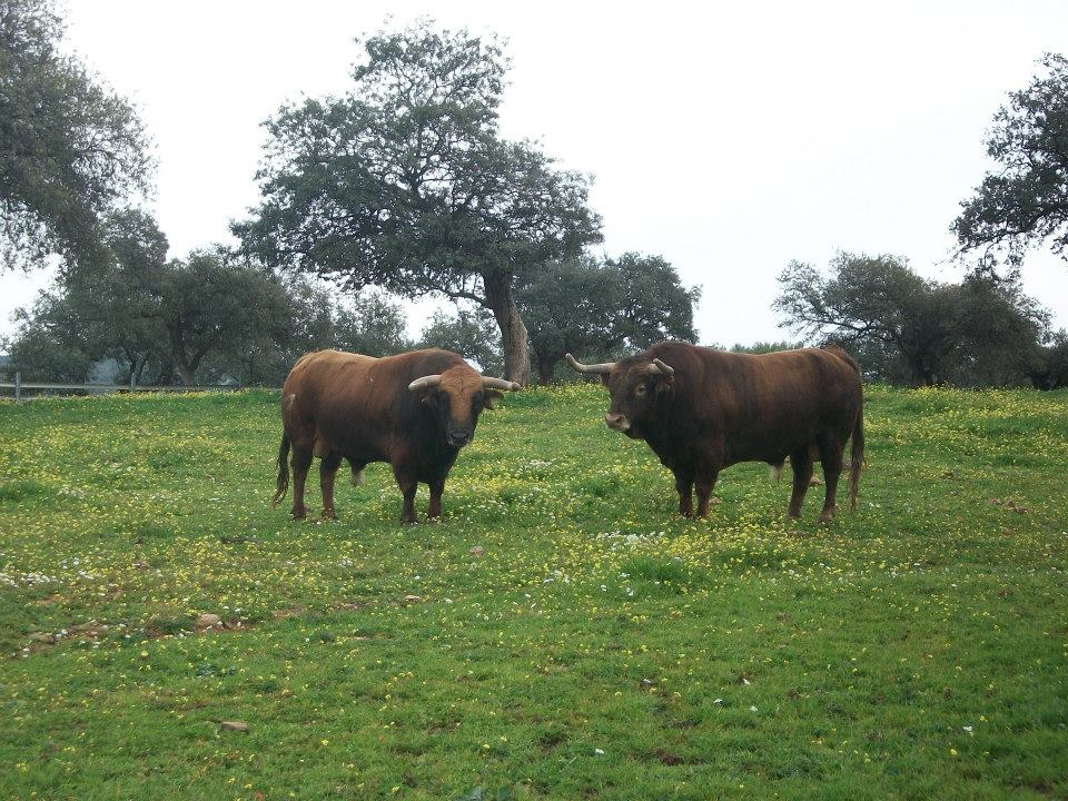
Escoriales, an area with fighting cattle
National Hunting Reserve Contadoro-Selladores
Centenillo
Old mining town - La Carolina
Viewpoint loa Alarcornes
Los Pastores Viewpoint.
La Aliseda recreational area.
DESCRIPTION
The route begins at kilometre point 0 of the J-5010 road to the Sanctuary of the Virgen de la Cabeza and Puertollano. During the first three kilometres we move between the family vegetable gardens and the irrigated land of the terraces of the Guadalquivir to pass, at kilometre point 4,500, through olive groves. From this point on, coinciding with the stallion's stop in the state, the terrain becomes more mountainous, first through scrub and pastureland, gradually passing into densely populated pine woods. At kilometre point 12,300 we can visit the Visitor's Centre of the Viñas de Peñallana Natural Park, a place where magnificent recreational estates, known as "Viñas", are located. At kilometre point 14.200, take the right-hand turn-off on the JH-5002 road, which runs through pine woods more or less mixed with mastic shrubs, kermes oaks and rockroses with a rich fauna and dedicated to hunting and livestock. At this crossroads there are two restaurants, the last place to have breakfast or an aperitif in two or three hours. The road is in a regular state of conservation.
Towards the 18th kilometre of the route, the pine forest disappears, the landscape is one of pastureland with mainly holm oak and cork trees, and there are panoramic views of the mountains on both sides. Around kilometre 21 there is a magnificent holm oak wood where the fierce bulls of the Finca de los Escoriales, founded in 1959, graze. At km 24,100 we find the Los Escoriales mines, which were already being exploited by the Romans. At km. 24,400 we find a crossroads and a tentative place. The turn-off to the left leads to the Jandula Reservoir. Continuing to the right you pass through the Tapicas farms, the Flores-Albarrán livestock farm, Navas de Benjamín Sorando or Los Alarcones de Samuel Flores, the latter since 1928, places where you can discover the wild bull in its midst, the protection and management fences, the feeding and watering places, along with some protected or hunting species. From km. 32.800 there are magnificent views that you should not miss: to the right, of the Sierra de Ambroz (761 m.), and to the left, of the Rumblar Reservoir and Burgalimar Castle, in Baños de la Encina. From here the road continues in a northerly direction, passing the large farmhouse of Los Alarcones. The landscape opens up to the Ambroz and Los Calderones mountains, at the northeastern end of the Sierra de Andújar Natural Park. At kilometre 42, and coinciding with the beginning of the National Sealers' Reserve, we can see areas of small pine woods that are intermingled with the pastureland and the scrubland; further on, the patches of pine woods are larger and denser, although some examples of cork oak remain. The road improves and becomes downhill, turning from the house of Selladores to the southeast. As we leave Selladores-Contadero, the landscape changes towards a bush mountain dominated by mastic trees and natural pastures. We arrive at Nava del Sach, at kilometre 64, where there are cave paintings that have been catalogued, and from here we go up to El Centenillo, an old mining town, in whose surroundings we can see many of the rubble from the mines that operated until the 1950s, now converted into a residential area. In this small town we can take a break to have an aperitif and taste the typical dishes of the place, including game stews and mountain products. We continue the last part of the route, already on a mountain road in perfect state of conservation until La Carolina, distant 16 km approximately, descending from El Centenillo until the Rio Grande, place in which the pine forest disappears definitively to continue already in land of scrub and grass and to cross the river of the Bell.
Follow us #JaénParaísoInterior


