


Río Aguamulas
Singular places
, Santiago Pontones
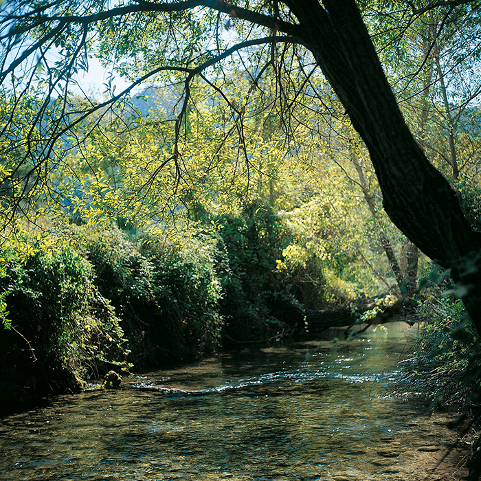
The Aguamulas is a small tributary of the Guadalquivir which passes through one of the park's most beautiful smaller valleys, flowing through numerous rapids and pools along the way. You can enjoy the sight and sound of the river as you make your way along a pleasant forest trail lined with pines, in the shade of which grows a dense Mediterranean vegetation of oaks, strawberry trees, mastic and terebinth. In the distance you can make out the imposing rock faces of Banderillas, whose peak rises to an altitude of almost 2000 metres.
The 9-kilometre-long forest trail follows a most pleasant route and you cannot lose it, as you simply have to stick to it (moreover it is signposted as GR-7). It stays close to the river and has very few ascents or descents, with the exception of one section where it splits into a series of rising curves. .
You do not need to go the entire length of the trail in order to enjoy this scenery, although if you do make it to the end you will be rewarded with a viewing point offering unforgettable views over the Recó del Aguamulas, a natural, rocky amphitheatre in which the river has its source and at the bottom of which are abandoned meadows and orchards.
You can also make out the now-ruined farmsteads of La Fresnedilla, which was home to the last inhabitant of these valleys; one Máximo Fernández Cruz, known as el Cojo de la Fresnedilla, or “the lame man of Fresnedilla”. This remarkable mountain-dweller fought for 30 years against the abandonment of the lands in which he was born and from which the one hundred or so residents of the area of Aguamulas were evicted, when the land was expropriated in 1960 in order to create the National Hunting Reserve. In 1982, Máximo paid for his resistance with a prison sentence.
We recommend…
- Keeping a look out for examples of the dark-green Spanish algyroides, which is endemic to the park and was discovered very near this spot in 1958.
- Continuing on beyond the viewing point and taking a walk around La Fresnedilla. If there is plenty of water you will see the cascades marking the source of the Aguamulas.
LOCATION
From the Llanos de Arance campsite (on the A-319), take the forest track which crosses the Guadalquivir. After 3 kilometres, and once you have forded the Aguamulas, turn right at the crossroads and continue on for a kilometre until you reach the barrier at Los Bonales Forest House, where you can leave your vehicle.
Follow us #JaénParaísoInterior


