


Stage 1: Campo del Espino Refuge - Coto Ríos

This long Stage of the GR 247 is very special because it runs through the very heart of the Natural Park, descending from the severe and imposing plateau of Los Campos de Hernán Perea, at 1700 meters of altitude, to the Guadalquivir Valley, at 1000 meters less altitude. This allows you to enjoy strong landscape contrasts that are a good example of the diversity of environments in these mountains.
We will begin the route in the treeless high pastures of Los Campos, with wide panoramic views and clear skies. From there we will go down to the village of La Hoya de La Albardía, uninhabited, in a secluded and beautiful plain surrounded by mountains.
Then we will take a path that goes down a wild ravine covered with pine trees to another emblematic place of the Natural Park, the Cortijada de La Fresnedilla, at the foot of the impressive Banderillas cliffs, and that was the scene of the resistance of the last inhabitant of these places, Máximo Fernández Cruz, nicknamed “El Cojo de la Fresnedilla”, against the forced expulsion of the people who lived in these valleys until the 1960s.
...This long Stage of the GR 247 is very special because it runs through the very heart of the Natural Park, descending from the severe and imposing plateau of Los Campos de Hernán Perea, at 1700 meters of altitude, to the Guadalquivir Valley, at 1000 meters less altitude. This allows you to enjoy strong landscape contrasts that are a good example of the diversity of environments in these mountains.
We will begin the route in the treeless high pastures of Los Campos, with wide panoramic views and clear skies. From there we will go down to the village of La Hoya de La Albardía, uninhabited, in a secluded and beautiful plain surrounded by mountains.
Then we will take a path that goes down a wild ravine covered with pine trees to another emblematic place of the Natural Park, the Cortijada de La Fresnedilla, at the foot of the impressive Banderillas cliffs, and that was the scene of the resistance of the last inhabitant of these places, Máximo Fernández Cruz, nicknamed “El Cojo de la Fresnedilla”, against the forced expulsion of the people who lived in these valleys until the 1960s.
Later, the route runs along the Aguamulas River, one of the first mountain tributaries of the Guadalquivir, with clean and wild waters, where common trout roam and the aquatic blackbird jumps from rock to rock. Always immersed in the forest, we will accompany this river to its mouth in the Guadalquivir. Then we will walk placidly near the latter, the great river of Andalusia, which here is still very young, but with a wider channel and calmer waters than its tributary, the Aguamulas.
The Stage ends in the Village of Coto Ríos, a pleasant and quiet place on the banks of the Guadalquivir, located in a very strategic place from the tourist point of view and the starting point of the second Stage of this Variant, which will take us to the slope opposite the Guadalquivir Valley.
For touring part of the less inhabited and more abrupt places of the Natural Park, our route is an excellent setting -if luck is with us- to see up close fallow deer, deer, mouflon, wild boar and mountain goats, as well as vultures and various raptors Without forgetting that we may be lucky enough to see some of the bearded vultures that have been reintroduced into the Park fly.
Technical information
Route Name Rutas Bosques GR247
Rutas Bosques GR247 2: Stage 1: Campo del Espino Refuge - Coto RíosHUSO 30S
Refugio Campo del Espino: x524439 y4209665
Coto Ríos: x513523 y4211181
Refugio Campo del Espino: x524327 y4209457
Coto Ríos: x513412 y4210974
TOTAL DISTANCE (IN KILOMETERS)22500
Asphalt or cement section 0,44%
Section of track or forest road or promenade 75,11 %
Senda section 24,45 %
tramos-de-Vía-pecuaria 0 %
ESTIMATED RUN TIMEO
5 h 55 minMAXIMUM SLOPE1085 m
DIFFICULTY. ASSESSMENT ACCORDING TO METHOD MEASURE
2
MEDIO.
Severity of the natural environment
2
Itinerary
Orientation in the itinerary
2
Displacement
Difficulty moving
3
EFFORT.
Amount of effort required
TOTAL DISTANCE (IN KILOMETERS) 19540 M
Start
The Campo del Espino Refuge is reached by forest track from the village of Don Domingo and from the Nacimiento del Segura
Final
Coto Ríos is accessed from Cortijos Nuevos and from Cazorla by the A-319 road
CYCLABILITY
The Stage runs along a path between kilometers 2.9 and 8.4, where there will be some sections with steep slopes, especially in the last 700 meters.
WATER POINTS
Campo del Espino Refuge (cistern), Los Bonales Forest House, Coto Ríos
PREFRESHING POINTS
On the trail: Coto Ríos
Near the trail: No
LINKS WITH OTHER TRAILS
GR 7
Rutómetro
Campo del Espino Refuge
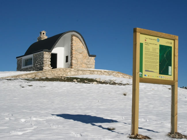
The Stage begins in the shepherd's refuge of Campo del Espino, at an altitude of 1,700 meters, in the middle of the imposing plateau of Los Campos de Hernán Perea, the kingdom of the Segureña sheep, a vast territory with a high altitude and almost treeless. We start the Stage by following the signposted path in a northwesterly direction, having to our right the mountain range of Pinar del Risco, with steep slopes covered by black pine trees, and which we are approaching obliquely.
After 1.2 kilometers we pass a barrier that prevents the passage of vehicles. The views are vast. From kilometer 2.2 we walk through a ravine, the path being less panoramic than before, and scattered pines and creeping junipers appear.
Hoya del Ortigal
We arrive at this small plain surrounded by hills where there is an important signposted crossroads. Towards the north, following the GR 7, we would go towards the Nacimiento del Río Segura and Pontones. A part of that road, from the fantastic Mirador de Juan León to near the Nacimiento, is included in the GR 247 as Derivation 6. Our route, however, continues towards the west, coinciding with the GR 7 until Coto Ríos.
As we cross the hole we pass another barrier and the landscape changes radically. We begin to enter the forest, leaving the severe sobriety of Los Campos to begin a long descent that will end in the Guadalquivir Valley, at an altitude of about 1000 meters below. We begin the descent through a narrow canyon between rocks and pine trees. The hawthorn abounds and some maples appear, while in the sky it is easy to see vultures and some mouflon may surprise us.
At kilometer 3.5 the ravine ends and, as the path turns to the right, the views become much wider, with the peaks of Morra de Las Hormigas ...
Hoya del Ortigal
We arrive at this small plain surrounded by hills where there is an important signposted crossroads. Towards the north, following the GR 7, we would go towards the Nacimiento del Río Segura and Pontones. A part of that road, from the fantastic Mirador de Juan León to near the Nacimiento, is included in the GR 247 as Derivation 6. Our route, however, continues towards the west, coinciding with the GR 7 until Coto Ríos.
As we cross the hole we pass another barrier and the landscape changes radically. We begin to enter the forest, leaving the severe sobriety of Los Campos to begin a long descent that will end in the Guadalquivir Valley, at an altitude of about 1000 meters below. We begin the descent through a narrow canyon between rocks and pine trees. The hawthorn abounds and some maples appear, while in the sky it is easy to see vultures and some mouflon may surprise us.
At kilometer 3.5 the ravine ends and, as the path turns to the right, the views become much wider, with the peaks of Morra de Las Hormigas and La Molata in the foreground, both of which are just over 1600 meters high. altitude, towards the southwest the Banderillas cliffs and to the west, in the distance, the Sierra de Las Villas, on the other side of the Guadalquivir.
Below, to our left, the uninhabited village of La Hoya de Albardía appears, through which we will soon pass. At kilometer 3.9 we find a very beautiful tornajo, made with several large and straight black pine trunks, with which in the past the troughs for cattle were made by hand.
It is a good place to stock up on water. At kilometer 4.3 we leave the path we are taking and turn sharply to the left to go down to the village. If we continued straight ahead, heading north, we would go towards the Collado de Los Frailes, and further down we would descend to the exceptional spot of the village of Los Centenares, also uninhabited, through paths that should not be ventured if you do not know each other. .
This village, like those of Los Miravetes and Las Canalejas, all unpopulated, constitute not only places of unspeakable beauty, but also important milestones in the collective memory of the Segura region, since its abandonment was forced by the State when it was created the Cazorla-Segura National Hunting Reserve in the 60s of the 20th century.
This part of the Sierra was dehumanized in a coercive way to dedicate it primarily to hunting big game, creating an unnecessary conflict with dramatic human and social consequences at a time when Spaniards lacked the democratic rights that we consider elementary today.
Following our route, we quickly went down to the village of La Hoya de La Albardía, walking to one side and the other of the stream whose waters gave life to the village.
La Hoya de La Albardía
This village, at 1,460 meters of altitude, is made up of a few houses, humble and already in ruins, under which a narrow and beautiful plain extends. It is a very special place on the GR 247 Trail because this village has been uninhabited since the same time as the ones we mentioned before.
Knowing the dramatic history of its ancient inhabitants, we will better understand the current landscape of the places we are visiting, probably with a bittersweet feeling, in which sadness for a very hard past and the feeling of fullness that the harmony of the landscape produces. , with its old sowing terraces, fruit trees and walnut trees, small poplar groves next to the stream, all surrounded by mountains covered with forests.
We cross the nava following the beacons, since the path is not very defined, and having the stream on the left. The presence of fallow deer and mouflon is frequent in this meadow, especially in winter. When you get to a small poplar tree, you have to cross the stream, paying attention to the beacons. When the veguilla ends we leave it around the base of the hill that we have to the left, in a gentle ascent and always looking at the beacons. We will see some poplars and a farmhouse. We cross some wide terraces and pass by the Tiná de Las Hoyas, which is signposted as such.
Path of Los Horcajillos
Just after passing Tiná, a narrow path marked with a beacon emerges, which we have to take. At this point we appreciate a new and abrupt change of environment. We leave the soft and humanized landscape of Las Hoyas behind and we descend into the forest again along a small path through which we will cross a long ravine, through the place known as Los Horcajillos.
At less than a hundred meters we have to cross to the other side of it, paying close attention to the beacons, and from that moment the stream will be on our right. Little by little the ravine widens and our path is higher above the stream, always among pine trees. In the front and in the distance, the rocky mountains of the Sierra de Las Villas appear, while to the right the cresterias of Morra de Las Hormigas and Puntal de Las Cabras loom over their pine forest slopes.
As we go down, the black or salgareño pines become taller and more robust, being accompanied by junipers and blackberry junipers.
Collado
At this point our path turns to the left and changes slope, remaining on the lower right, in the ravine that we left, the Cortijo de Cubero, also uninhabited. The views on this hill are impressive, as we have to the left, very close, the spectacular Banderillas cliffs.
The path descends from here with a steeper slope and makes continuous breaks. The pinar de laricio becomes more closed, so we lose the views towards the Banderillas. To the right we have the Castellón de Los Toros, whose characteristic rocky platform that crowns it we can hardly see from here, but which is unmistakable from the top of the Banderillas and from many other points. Junipers abound on our path and when we reach the bottom of the ravine, boxwood appears next to the stream.
Crossing to the Cortijo de La Fresnedilla
At this point a tiny path emerges to the left with a beacon in the wrong direction. It is convenient to deviate along it a few meters and reach the small farmhouse of La Fresnedilla, abandoned many years ago. It is a place of extraordinary beauty where it is worth stopping in peace, because it is one of the most attractive points of the GR 247, since the most rugged is combined with the testimonies of the human settlement that existed in the place until the years 70 of the 20th century.
The last resident of La Fresnedilla was Máximo Fernández Cruz, nicknamed “El Cojo de la Fresnedilla”, who resisted until the end against the forced expulsion of the people who lived in these valleys until the 1960s and ended up being imprisoned. .
We will contemplate old terraces, large walnut trees and some ruins, all already abandoned, but what impresses the most is the majesty of the place where its ancient inhabitants lived, almost at the foot of the high and vertical walls of Banderillas, one of ...
Crossing to the Cortijo de La Fresnedilla
At this point a tiny path emerges to the left with a beacon in the wrong direction. It is convenient to deviate along it a few meters and reach the small farmhouse of La Fresnedilla, abandoned many years ago. It is a place of extraordinary beauty where it is worth stopping in peace, because it is one of the most attractive points of the GR 247, since the most rugged is combined with the testimonies of the human settlement that existed in the place until the years 70 of the 20th century.
The last resident of La Fresnedilla was Máximo Fernández Cruz, nicknamed “El Cojo de la Fresnedilla”, who resisted until the end against the forced expulsion of the people who lived in these valleys until the 1960s and ended up being imprisoned. .
We will contemplate old terraces, large walnut trees and some ruins, all already abandoned, but what impresses the most is the majesty of the place where its ancient inhabitants lived, almost at the foot of the high and vertical walls of Banderillas, one of the highest mountains in the Natural Park. Raptors and large ungulates, such as deer, ibex and fallow deer, are frequent to observe.
From the same walls of Banderillas, in the Cueva del Nacimiento, the Aguamulas River is born, whose waters break on some occasions forming spectacular waterfalls, which cannot be seen from our route. Returning to our path, we crossed the stream and immediately reached the next milestone on our route.
Aguamulas viewpoint
Our path reaches a great viewpoint, which is where the forest track that rises from the Guadalquivir Valley ends and that we will follow from now on. But first, it is worth stopping again, because from the viewpoint we can see the same landscape as from La Fresnedilla, but from the opposite side, being able to better appreciate the imposing Banderillas and all its surroundings.
Restarting our route, the atmosphere changes again. Now we are walking along a forest track in a gentle descent, in the middle of a one hundred percent forest landscape. The valley, very narrow at the beginning, opens up little by little, and down to the left we always hear the singing waters of the Aguamulas, a short but clean and wild river, which we will accompany until its mouth in the Guadalquivir.
The presence in this river of common trout and aquatic blackbird, easily observable, are good indicators of the excellent state of its waters. As we go down, the vegetation becomes more Mediterranean, with mastic, juniper and olive ...
Aguamulas viewpoint
Our path reaches a great viewpoint, which is where the forest track that rises from the Guadalquivir Valley ends and that we will follow from now on. But first, it is worth stopping again, because from the viewpoint we can see the same landscape as from La Fresnedilla, but from the opposite side, being able to better appreciate the imposing Banderillas and all its surroundings.
Restarting our route, the atmosphere changes again. Now we are walking along a forest track in a gentle descent, in the middle of a one hundred percent forest landscape. The valley, very narrow at the beginning, opens up little by little, and down to the left we always hear the singing waters of the Aguamulas, a short but clean and wild river, which we will accompany until its mouth in the Guadalquivir.
The presence in this river of common trout and aquatic blackbird, easily observable, are good indicators of the excellent state of its waters. As we go down, the vegetation becomes more Mediterranean, with mastic, juniper and olive trees (Phyllirea angustifolia), as well as junipers, accompanying the Aleppo pines.
We also see some maples and gall oaks. Meanwhile, we continue to see the Banderillas mountain range to the left
From kilometer 10 there are views in front, intermittently, towards the Sierra de Las Villas, and a little further on we see the Majal Alto, whose summit is identified by having an antenna. The track makes a series of curves to save the unevenness and descend almost to the Aguamulas course, while the forest is increasingly rich, with many strawberry trees and a lot of holm oaks.
At kilometer 13.4 we can clearly see the river below to our left, and soon we are almost at its side, enjoying the proximity of its waters and its riverside vegetation, seeing in the background, to the left, the unmistakable silhouette of the Piedra del Mulón.
Arroyo del Hombre
At this point, known as Los Caracoles de las Juntas, the Arroyo del Hombre converges on the right, which comes from the aforementioned Cortijo de Cubero. A path starts next to the stream, next to a small dam, which would take us to the Cortijo del Arroyo del Hombre, also called Cortijo del Tío Ratón.
It is interesting to take a detour along this path, since, after a little less than two kilometers, we will discover a surprising place, because the tiny and primitive rooms of the aforementioned farmhouse are excavated in the same rock, constituting an extreme example of man's adaptation to the conditions offered by the mountain environment.
Continuing along our route, the lushness of the forest is increasing, especially on the opposite shore, which faces north and is known as La Asperilla Húmeda.
House of the Tables
In this place, where the Arroyo de la Campana converges with the Aguamulas, there is a small path to the left, in the opposite direction, which goes down to the river, being a good place to deviate a few meters from the route and comfortably approach its waters, enjoying of a small meadow with ash trees and poplars. There are usually some logs that facilitate the crossing of the river.
If we use them we must ensure that they are in good condition. Once on the opposite side there is another nice meadow. Continuing along our route, at kilometer 17.3, we find a wonderful fountain on the right, and a few meters further on, the Casa Forestal de los Bonales, where there is a barrier that prevents the passage of vehicles on the track we are traveling. Our route continues forward.
Guadalquivir track
This point is an important crossing, since we have reached the forest track that runs along the right bank of the Guadalquivir, which becomes the tail of the Tranco reservoir when there is a lot of water. To the right, this track runs through places of great beauty and ecological relevance. In fact, the Félix Rodríguez de la Fuente Route runs through it, in honor of the unforgettable naturalist who recorded here some sequences of his documentary series “El Hombre y la Tierra”.
If we traveled this route, we would reach two magnificent viewpoints, the Mirabueno, 2.3 kilometers away, and the Cabeza de la Viña, 6.6 kilometers away.
To continue our route we must turn left at the aforementioned junction, admiring the beautiful oaks (gall oaks), and observing that the presence of poplars and ivy denote the freshness of the place despite its low altitude (660 meters). After a few meters you will reach the Aguamulas fish farm, which is usually open to the public, and immediately we cross the river over a bridge, already a few meters from its mouth in the Guadalquivir.
The route then continues along the Guadalquivir, which is on our right, much wider and tamer than the Aguamulas. The great gall oaks abound and the riverside vegetation is dominated by poplars, tarajes and willows. The track, whose last meters are asphalted, flats next to some meadows, passing by a campsite.
Road to Coto Ríos
At this point we turn left along a narrower track, which ascends, heading towards the village of Coto Ríos. We leave the cemetery on the left and go through a pine forest of Aleppo pine with a closed Mediterranean undergrowth in which holm oaks and mastic trees abound.
Coto Rios
This village, on the banks of the Guadalquivir, marks the end of our long Stage. It is a small town that was created in the mid-twentieth century by the so-called National Institute of Colonization to welcome the mountain people who were expelled from their farmhouses in the mountains when the Cazorla-Segura National Hunting Reserve was created. .
Subsequently, its privileged location in the Guadalquivir Valley and the proximity of several campsites have made this young village a strategic place. The presence of the Guadalquivir, with clean waters that have not yet been dammed, and the high mountains that flank its valley, make Coto Ríos a truly charming place.
Additional information
Los tornajos: an ethnographic heritage and a habitat for lost fauna
In this and other Stages of the GR 247, the hiker will see old pine turns which are very characteristic of these mountain landscapes, especially in the high areas where sheep are abundant.
The tornajos are troughs that were made by hollowing out a pine, which was placed next to a fountain or spring in the middle of the mountain to retain the circulating water and facilitate its availability for livestock. The pine used was the salgareño, which is how the black pine (Pinus nigra ssp. Nigra) is called here. The set of several tornajos, arranged so that some pour over others, is called tornajera.
The usual thing in other areas of Spain is that these troughs were built with stone, but here the pine was always more successful, both for its availability and for its resistance, since, as long as the tornajo has water, its cracks close due to dilation of wood and lasts decades.
Little by little, the traditional tornajos of the Sierras are disappearing. And wi ...
Los tornajos: an ethnographic heritage and a habitat for lost fauna
In this and other Stages of the GR 247, the hiker will see old pine turns which are very characteristic of these mountain landscapes, especially in the high areas where sheep are abundant.
The tornajos are troughs that were made by hollowing out a pine, which was placed next to a fountain or spring in the middle of the mountain to retain the circulating water and facilitate its availability for livestock. The pine used was the salgareño, which is how the black pine (Pinus nigra ssp. Nigra) is called here. The set of several tornajos, arranged so that some pour over others, is called tornajera.
The usual thing in other areas of Spain is that these troughs were built with stone, but here the pine was always more successful, both for its availability and for its resistance, since, as long as the tornajo has water, its cracks close due to dilation of wood and lasts decades.
Little by little, the traditional tornajos of the Sierras are disappearing. And with it culture, landscape and biodiversity are lost. Many of them have been replaced, first, by cement troughs, and later, by metallic ones, with a squeaky aesthetic.
With each tornajo that is lost, a portion of the cattle culture and its artisan trades are gone. An element is leaving that gives character and personality to the mountain landscape.
The footprint and memory of the people who have shaped that landscape is gone. Even a bit of our natural heritage is gone, because each tornajo represents a small ecosystem that makes the most of that magical and always scarce element that is water: these small wooden rafts are a paradise for amphibians, including the small Iberian midwife toad (Alytes dickhilleni), a species exclusive to the southeastern Iberian mountain ranges whose tadpoles happily thrive in tornajos, but are cooked in metal troughs.
In short, tornajos are a small but significant exponent of all the good that happens when there is harmony between man, nature and culture, deep down, three ways of saying the same thing.

Follow us #JaénParaísoInterior


