


Cresta de Matamulos - C.Hazad.
Routes
Three hours
Approach by vehicle from the Quiebrajano Highway to the Cañada de las Hazadillas. One of the trails to get to know the Monte de la Sierra Periurban Park in depth.
Program
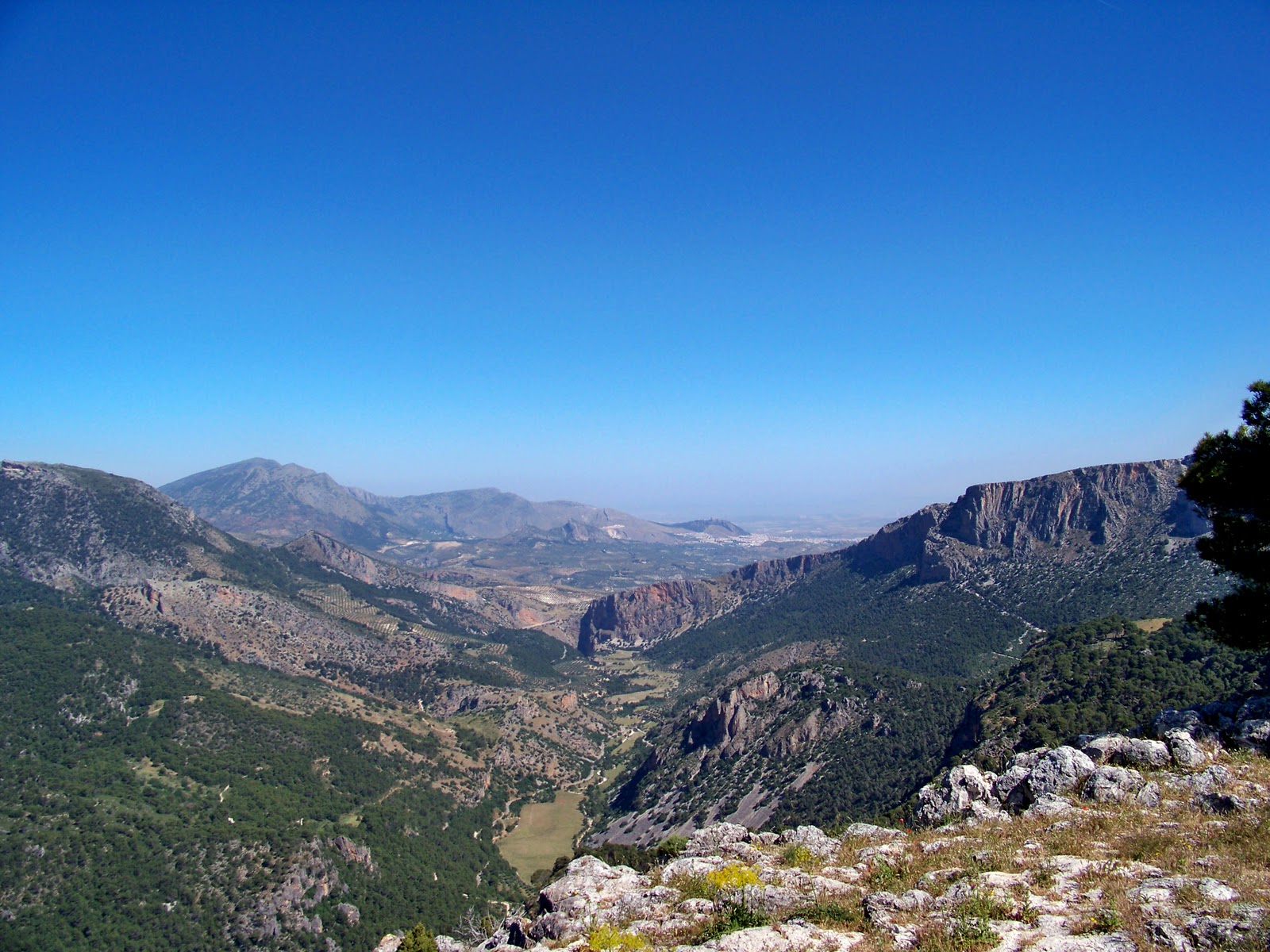
We take the track that starts next to the Nature Classroom towards Llanos de Palomares; approximately 1 km away we will find a crossroads where an indicator board indicates a 4x4 route to the town of Cárchel (same starting point as the Cruz de la Chimba route). We take the track to the right, cut with a chain, and after traveling about 500 meters in a sharp curve, a path emerges to the left that enters a ravine and ends at the Pocico pass. We leave the track and take that path. Soon we will come across a fork and we will take the path to the left. The path passes through a dense pine forest and after overcoming a somewhat steep section of slope, it leaves the forest area. A few meters away is the Cresta de Matamulos and the prop of the same name (1256 m). From there, the mountain falls almost steeply towards the Quiebrajano River. We have magnificent views of the reservoir and all the mountains in the area. If we turn to our right, we will reach the Cueva del Montañés, on the same summit of Matamulos. The views of the valley and Thieves Throat are impressive.
From there we will return in the opposite direction towards the Llanos de Palomares until we take the track that will take us down again to the Cañada de las Hazadillas at the head of the valley. In case of doubt, it is recommended to return by the same itinerary for going.
Follow us #JaénParaísoInterior


